
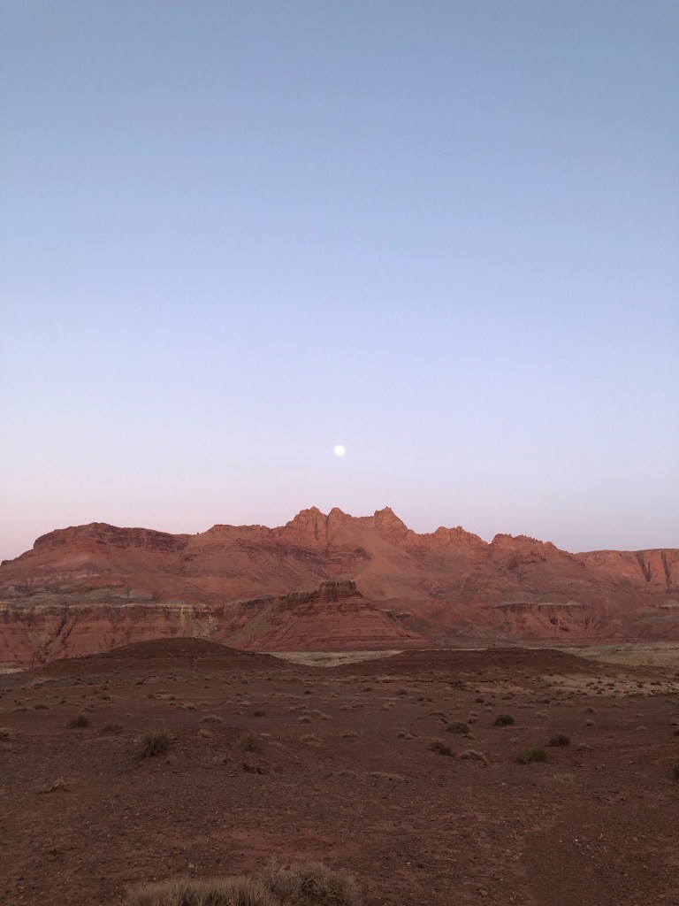
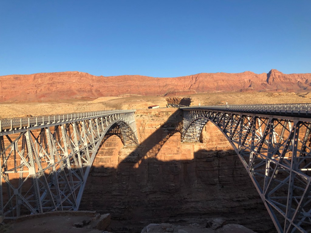
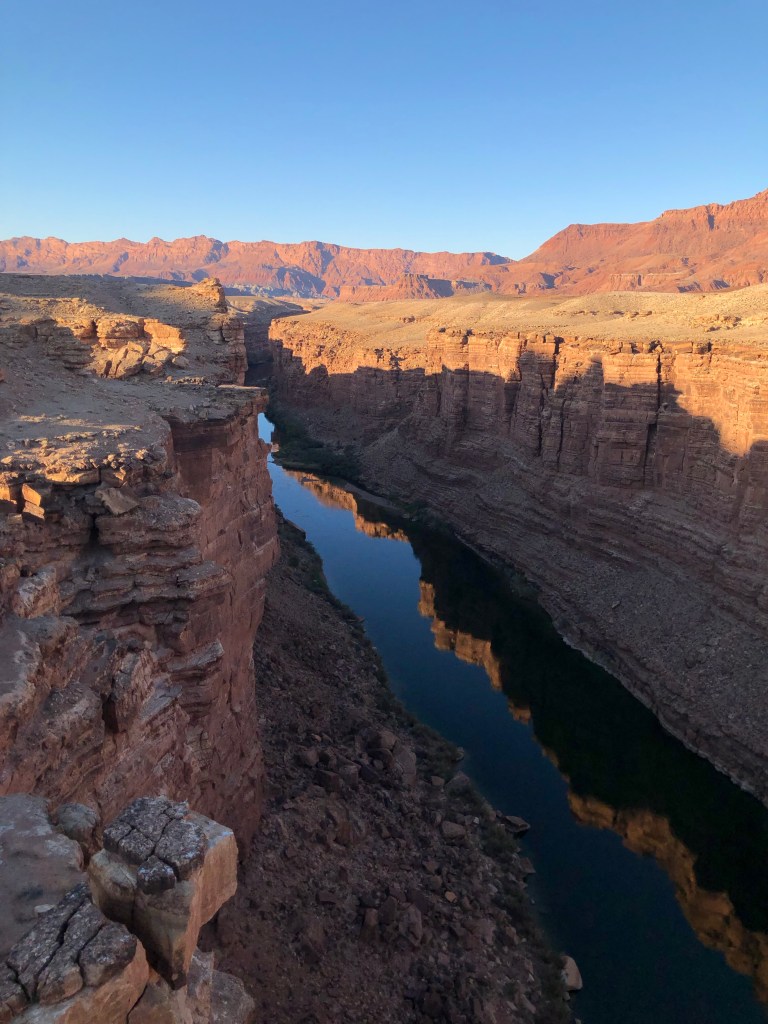
After leaving Zion we headed for Marble Canyon to spend a night before the Grand Canyon’s north rim opened for the season the following day. We treated ourselves to a motel stay at the Marble Canyon Lodge adjacent to the historic Navajo Bridge that connects Arizona’s isolated north strip to the rest of the state. From here we explored Lee’s Ferry, a launch site for rafters and kayakers onto the Colorado River. From here adventurers can sail south to the Grand Canyon. It’s also one of the rare points in the canyonlands where one can easily reach the river.
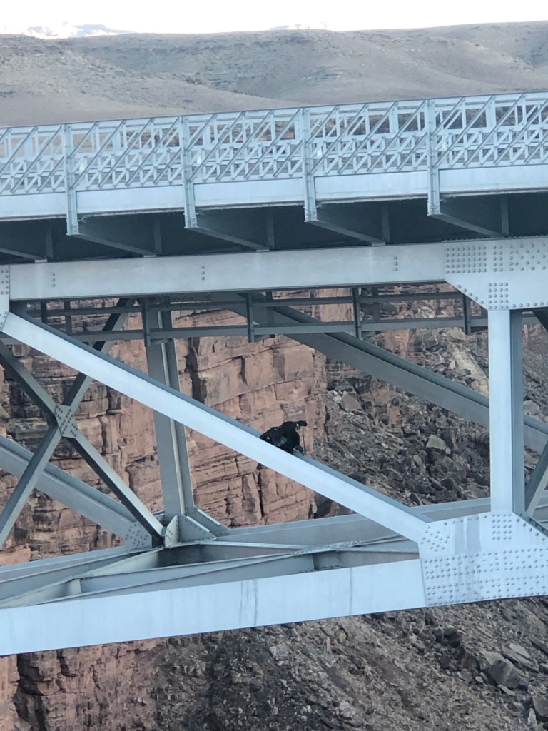
We also took a walk onto the bridge where we met a crew of bird enthusiasts camped out and monitoring some rare California Condors. They let us look through their scopes at the birds and regaled us with loads of fascinating stories of how a species on the brink of extinction 50 years ago in large part due to lead poising (bullets left in carrion by hunters), is coming back ever so slowly.
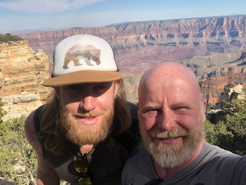
Years ago Dad and I were in Las Vegas for a wedding and we took the opportunity to visit the south rim of the Grand Canyon. Dad loved that visit and a photo of him seated on a rock at the edge of the rim of the canyon at sunrise was included in his published obituary.
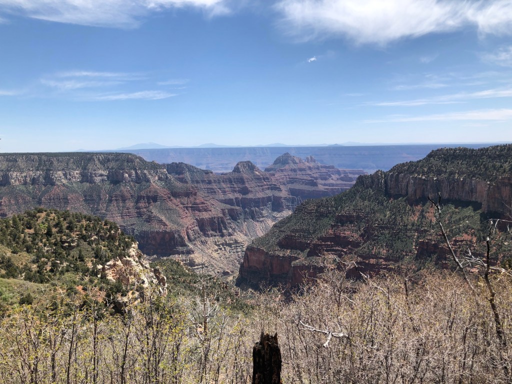
I had heard the north rim is actually the better place to see the canyon so my partner and I made sure to include this in our trip plans. The north rim is much more remote than the south rim which is only a short drive off an interstate highway. The north rim is more than an hour’s drive off US 89A, a remote desert highway skirting the Vermillion Cliffs which form the northern barrier to a desolate and barren patch of desert landscape. In the miles leading up to Jacob Lake, a hamlet at the junction of 89A and the road to the north rim, the high plateau that leads to the Grand Canyon stands before you running north to south. The long drive around the Vermillion Cliffs to the road junction is to position you on that plateau from which you drive south through rolling hills of meadows and forests of pine and aspen. The beauty of the landscape is a great distraction from the overwhelming anticipation one feels for jaw dropping vistas of the canyon. We saw lots of deer along here, grazing peacefully and still sporting their winter coats.
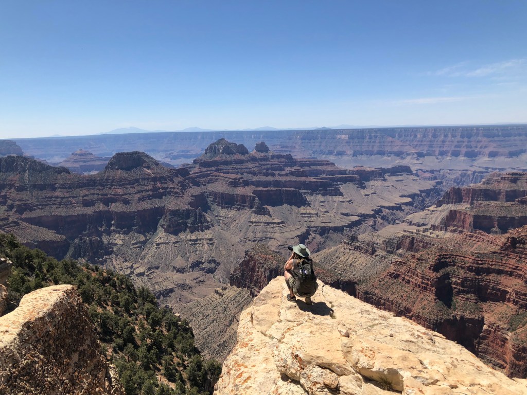
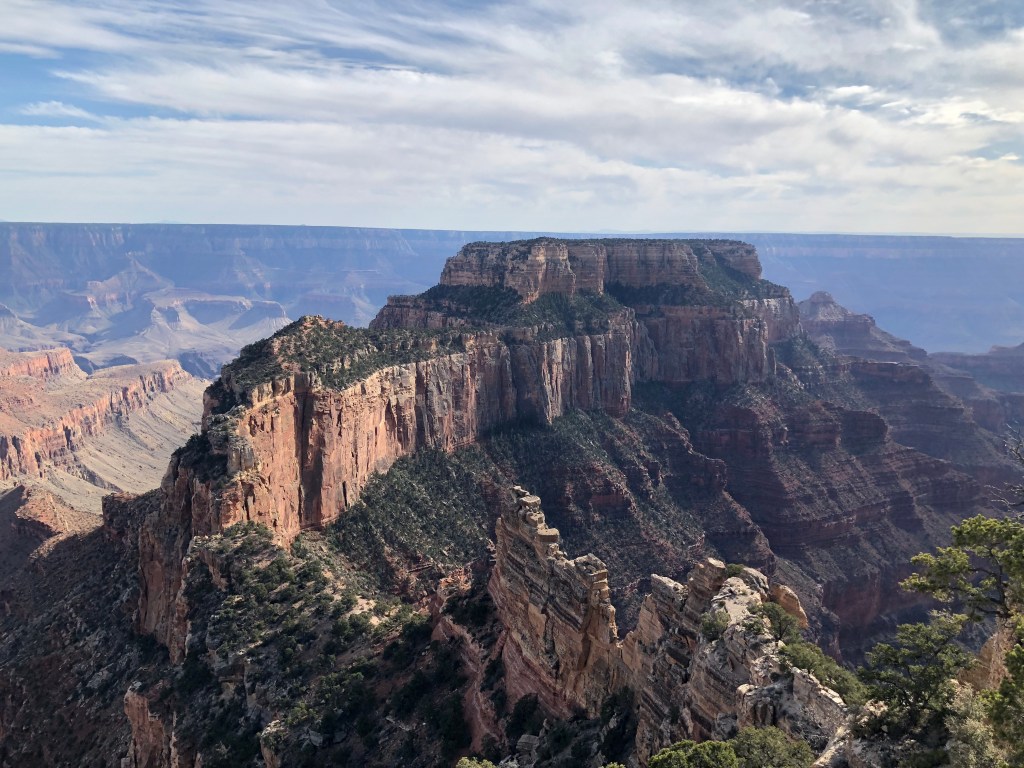
The Grand Canyon must be experienced to believe it. In my travels I’ve never seen anything like it and the number of times I hear travellers from other parts of the world referring to it as one of their favourite travel experiences signifies its uniqueness. If you travel to the north rim, don’t waste your time with the area around the lodge. The views from here and the surrounding trails don’t seem to be of the main canyon and you can’t see the river. As we were exploring this area I said to my partner “This isn’t right. We’re missing the money shot.”
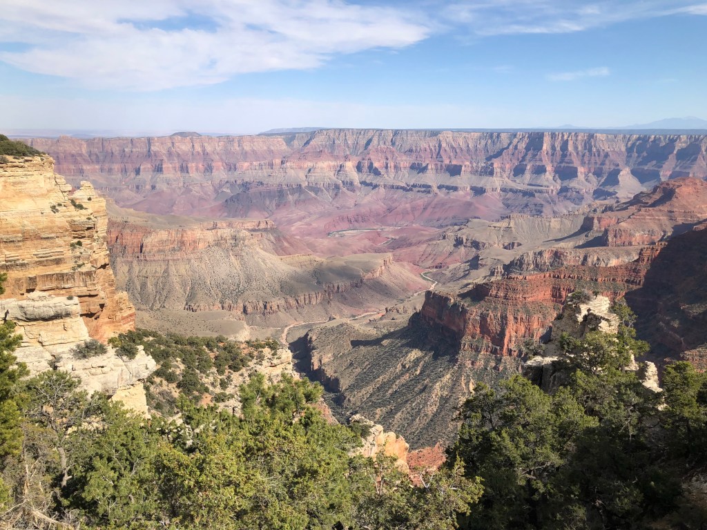
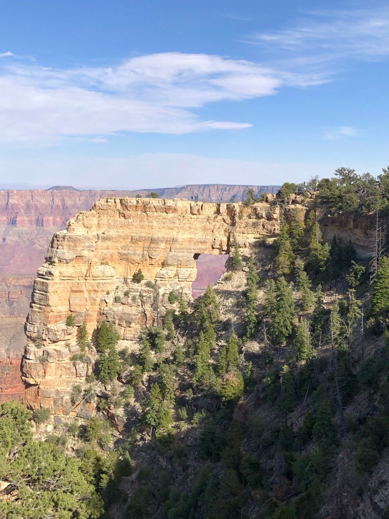
Then we figured it out. To see the river, take the 30km Cape Royal Road. It’s full of hairpin turns so give yourself lots of time. We were lucky, because we arrived on the first day the north rim opened, traffic was very light. By the time we got to the Cape Royal lookout there was only one other family there and they soon left. From here you not only see the south rim and the river but you also have a stunning view toward the west of the canyon. As we contemplated our surroundings the silence was broken only by the buzzing of giant bluish black carpenter bees (they look like Romulan warbirds) and the occasional rush of a hawk or falcon swooping by to plunge the depths of the open canyon below you.
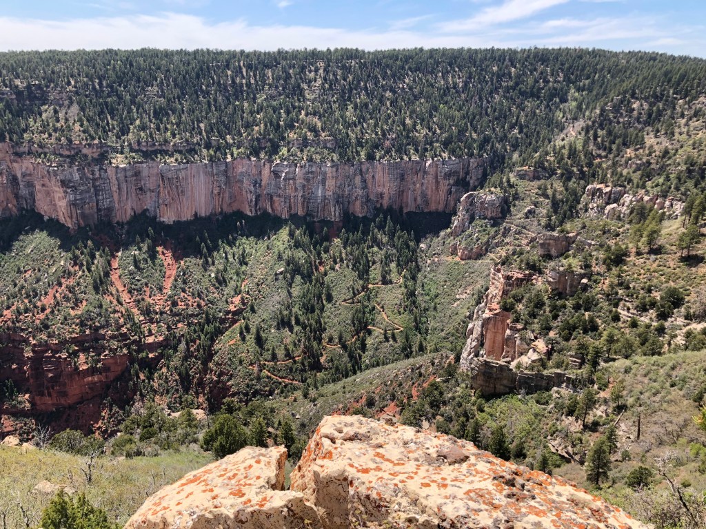
After a long day of hiking park trails (we did the Uncle Jim trail which I would recommend) and driving the scenic roads we retired back to Demotte campsite for a chilly night and a near full moon. We woke up before dawn to catch a rare planetary alignment and a lunar eclipse but it was cloudy. Ah the vagaries of nature. We got up early anyway so we could get a jump on our next destination – Death Valley in California.
Our drive took us through Las Vegas though we only stopped there for a quick lunch. We are deliberately avoiding cities on this trip, particularly those that we could easily fly to on some future trip. Besides, cities are money pits and this trip is costing a queen’s ransom in gas. So after lunch we got back on the road to drive through the most punishing terrain of the trip so far. The temperature in Vegas was a brisk 37C and would only rise from then on. The area in Nevada west of Vegas is a blight of endless gas stations, strip malls and casinos. The most populous community, Pahrump, is best known for making English its official language and banning foreign flags from being displayed.
We had originally planned to camp overnight in the park but the air temp at 45C at 4 pm and the night time projected to be 28C we decided to press on to the west of the park to cooler climes. The drive out was challenging as we rose from -200 feet below sea level to nearly 5000 ft above sea level in the space of about 40 km, only to plunge back down to 1000 ft in a mere 20 km more. My poor car with its small engine was pushed to the limit. The scenery in the late afternoon desert sky was desolate but beautiful and we had the road to ourselves.
We made camp for the night in a primitive campsite in a valley squeezed between two walls of Sierra Nevada mountains. At $6 a night the Bureau of Lands Management (BLM) campgrounds are a great deal. As we were getting ready for bed we were a bit confused by a halo of light coming from behind the eastern wall of mountains. Then we realized it was the full moon about to put on a show. We went to bed with the tent fly open so we could watch the moon light up the ghostly landscape around us. What a priceless moment.
